|
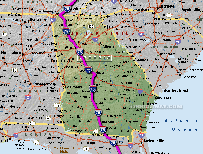
The i-75 travels across Georgia in generally a north/northwest - south/southeast direction
... to the north; the i-75 travels into the state of
Tennessee,
and to the south; the i-75
travels into the state of Florida.
The total distance of the i-75 across the state of Georgia is approx. 355
miles long, which requires an approx. driving time of 5 hours and 55 minutes to complete when driving an average speed of 60 miles
per hour.
See also: Regional i-75 Georgia traffic maps;
Acworth,
Adairsville,
Adel,
Ashburn,
Atlanta,
Bolingbroke,
Brookwood,
Byron,
Calhoun,
Cartersville,
Cecil,
Cordele,
Dalton,
Forest Park,
Forsyth,
Hahira,
Kennesaw,
Lenox,
Locust Grove,
Macon,
Marietta,
McDonough,
Morrow,
Perry,
Phillipsburg,
Ringgold,
Smyrna,
Sparks,
Tifton,
Unadilla,
Unionville,
Valdosta
and Vienna.
SEE ALSO:
i-75 Georgia Traffic Map. |