|
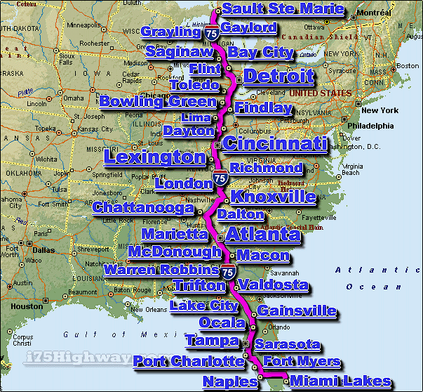
The I-75 Interstate 75 Highway is
a major US automotive & trucking transportation
corridor and interstate highway that travels generally in a north-south direction
across the Great Lakes and Southeastern regions.The i-75 travels through 6
different US states, including;
Florida,
Georgia,
Kentucky,
Michigan,
Ohio, and
Tennessee.
The i-75 connects a number of
large cities located along it's route, including;
Atlanta,
Cincinnati,
Dayton,
Detroit,
Flint,
Knoxville,
Lexington,
Tampa,
and
Toledo, to name a
few.
From it's north end, the i-75 starts at the Canada/US border between the US
state of Michigan and the Canadian province of Ontario (between the cities of
Sault Ste. Marie)... travelling in generally a south direction along the the
1,786 mile length of the i-75, the interstate highway ends in the western
portion of the metro Miami Florida area.
The entire length of the I-75 is approx. 1,786 miles long (2,875 km.), and
requires a continuous driving time of approx. 29 hrs. and 47 minutes to complete
- when averaging 60 miles per hour.
We currently provide real-time
traffic maps
for over a dozen cities located along the i-75 corridor, as well as,
i-75 corridor news, and
i-75 corridor weather.
|